 |
|
| |
View previous topic :: View next topic |
| Author |
Message |
sbkelley

Joined: 20 Feb 2007
Posts: 284
Location: Tempe, AZ
|
 Posted: 5/26/2011, 9:08 am Post subject: Jemez Mountains 50k, New Mexico Posted: 5/26/2011, 9:08 am Post subject: Jemez Mountains 50k, New Mexico |
 |
 |
|
|
Hey all, not exactly a standard "hike", but I recently competed in a trail race in New Mexico, thought I'd share the story.
Jemez 50k mountain race
Distance: 32.9 miles
Elevation gained: 7781
Everything about the Jemez Mountain Trail Runs seems difficult from the outside looking in. Last year, I watched my mom compete in the 50 km (32.9 mile) race near Los Alamos, New Mexico, a race which stays almost exclusively on single and double-track trail through the mountains and canyons above town. The races low point is over 7000, and tops out around 10,500 and there seemed to be no flat part anywhere. Yet Tanya and I noticed that all the participants were smiling and enjoying the
experience, despite the obvious pain that many were in. That settled it in 2011, we wanted to try. Tanya, myself, and my mom all completed the course, and it was every bit worth it.
This entire spring from January to May became a dedicated training regimen pointed at this one goal. Run trails, lots of them, after work during the week and then do a longer run or hike on the weekend. We got to know South Mountain VERY well, I hiked up Piestewa Peak countless times, and the weekend workouts took us to challenging spots throughout the state. Arizonas sunny and rocky trails got us in great shape, but would it translate to success the mountains of New Mexico?
Saturday morning, race day, the alarm went off at 5 and Tanya, mom, and I loaded up our gear and drove over to North Mesa in the chilly 40-degree morning. The sun rose over the Sangre de Cristo Mountains across the valley and lit up everything in an orange glow. A good omen. In our race, there were 146 people. Since Tanya and I were so new to this, we just jumped in the pack somewhere. After a few nervous minutes, the gun went off. Here we go, I thought, what am I about to do to myself?
My inner musings were rudely interrupted when I noticed how fast some of the runners were moving off the line! I intended to ease into this thing, but some of the competitive ones started quickly on North Mesa Road, my mother among them. I let them go we had 32.5 miles to cover still. Tanya decided to hang back even more, wanting to settle into her own speed.
The course starts on a paved road for the first half mile or so before dropping off North Mesa and through an underpass. Once you hit dirt, thats the last pavement youll see to the finish line. By now, I tried to settle into my pace behind a good sized group. A quick descent put as at Rendija Canyon and onto the Perimeter Trail, and a couple miles of gradual climbing began here. My lungs were feeling the altitude already and my stomach was unhappy not a good start. Additionally, the pace was still faster than Id wanted to move, so I tried to throttle back through here. After all, I knew a big climb was coming. I caught up to and fell into pace behind another runner Rob, from Colorado and this guy would be my saving grace. I hate to admit it, but I was having doubts about completing this run at this point. That feeling would soon pass, but feeling crappy at mile 4 with a giant hill looming
well, it was intimidating. A veteran of longer runs, Rob was moving steadily and easy, so I decided to stay with him to the base of Mitchell Trail, a 1500 climb. We moved into a hiking pace up these switchbacks as the views got impressive of the Los Alamos area. The forest was gone here, claimed victim by the 2000
Cerro Grande Fire. Our conversation picked up, too, and the time passed quickly. Rob was using this as a training run for a 100-mile race in Wyoming soon. These guys in this sport are amazing. Soon we had
claimed Guaje Ridges top 6.4 miles down.
Now we caught a break, as the trail bombed steeply down into Guaje Canyon. Our conversation started attracting more followers, and soon we had a good chatty group moving down the canyon-side. We dropped 800 feet in a mile, through loose and narrow switchbacks. Good stuff. At the bottom, we climbed up a rebar ladder to surmount Guaje Reservoir, and soon it was time to climb again, albeit gradually. Rob and I cruised an easy pace through this stretch. The creek babbled through the spruce
and fir forest on this stretch, and the cool morning air felt good in the mountains. You miss that living in the desert. Before too long, Caballo Base Aid Station appeared. 9.4 miles down.
My dad was working this station, so I snapped a photo with him, grabbed some food, and faced the beast. The next stretch is infamous in the Jemez race, Caballo Mountain. Over the next two miles, we had to climb 1770 to the summit. The top was near 10,400, so this would test legs and lungs. Good thing Id been hiking so much. I caught up to Rob again soon and another woman (also from CO), and we moved together up the mountain. The Coloradoans remarked that they couldnt train at altitude before the race since the winter snows had rendered their mountains inaccessible, but a recitation of Phoenixs elevation seemed to end the complaints! I saw my mom coming back down Caballo as we neared the top, and I cheered her on. As you burst out of the forest and into Caballos summit meadow, the view is absolutely ridiculous, but you have little time to enjoy it. Back down we went, losing all that hard-earned elevation. I saw Tanya moving up as I was about halfway down, and soon I was back talking
with my dad at the base aid station. 13.4 miles down.

My dad and I at the Caballo Base Aid Station
The next part was a back-breaker. After all this climbing, the course greets you with yet another steep climb. Time to hike again
a 1000+ grind of a climb appears, which allows you to exit the canyon and enter easier terrain. This third big climb nearly flattened me. I kept eating, drinking, and taking electrolytes, but my legs were blowing up. I was passing people through this stretch, though. After what felt like never-ending steep switchbacks, mercifully, Guaje Point appeared and the terrain finally eased. 15 miles in, now most of the elevation gain was done. At this point, being so tired, I wondered aloud how the hell I was going to complete the other 17. Only one way to find out I started running again along the flat trail until I saw Pipeline Aid Station. 16.3 miles down.

Happy to be at Guaje Point, pointing back from whence I'd come atop the 3rd climb
This aid station was a welcome sight they had more food, drink, and people than the previous ones did. On top of that, the next stretch of trail was familiar territory from my high school days in Los Alamos. I knew there were 3 easy miles to the Pajarito Mountain Ski Hill from here (which Id have to turn around and do in reverse, but Id get to that later). Bursting over that hill into the view of Canada Bonita brought back some memories, which distracted the pain in the legs for awhile.

View of Canada Bonita in the Jemez Mountains
The ski hill came pretty quickly, where I saw my mom again heading out. My drop bag was here, so I shed my long sleeve undershirt since the day was getting warmer. More food down the hatch, a smile and wave to the
people there, and it was back to Pipeline Aid station. 19.2 miles down.
I was worried about the gradual incline of this next stretch, but it honestly felt ok. I fell in with another runner from Colorado (notice a theme?) through here. Pipeline Aid Station came again soon, and hope began to rise. I also learned it was only 1 pm, so Id been at this only 5.5 hours. My goal of an 8 hour finish was quite attainable. 22.0 miles down.
Hope ebbed immediately as we all turned the corner and saw the infamous hills of Pipeline Road next. Gross. Well, only one thing to do, start hiking up. By the time I topped out, I realized how tired ones legs can get.

View from top of Pipeline, looking at Pajarito Mountain
Though I was physically getting ruined by now, the mental spirits remained high. Thats the key to these races, I realized. Pipeline Road at last started descending back to town
only to be interrupted by another big
climb. Not funny. After that one, though, the descent began in earnest along the Guaje Ridge Trail. This narrow single-track was fun and hugged the steep hillside, so attention was mandatory. A shooting pain
was going through my knee on the steeper descents now. That cant be good, I thought, we still got a ways to drop. I ignored it accordingly. Down and down the trail went, and I wondered when the hell wed see the Guaje Ridge aid station. The trail moved out of the forest and into the burned area, and the temperature rose sharply in the sun. Though I initially viewed this with annoyance, I realized this could be the break I needed. More food and electrolytes into the system, and we came around a corner
to see a sign which read This seemed like a good idea 3 months ago! Touche, sign, touché. Gotta love the aid station volunteer humor. At last, Guaje Ridge Aid Station appeared. 25.7 miles down.
No aid for the next 5 miles, huh? 1700 of drop and no climbing? Ok, not so bad. I gave away some ibuprofen and bid farewell to my CO buddy as his knee was acting up shortly after the aid station. Downhill in the hot sun was all that lay between me and the finish. Now that Phoenix-based training didnt seem like such a handicap. I caught a second wind as the course warmed and I felt right at home on the sunny, rocky slopes of lower Guaje Ridge.

Guaje Ride descent - looking a little ragged now
The Cabra Trail junction signaled the end was near,
and it was here that I caught up to a runner (another Colorado one). It seemed we were mutually happy to have someone to talk to through this last bit, as she and I had each been running alone. The
Cabra drops sharply into a canyon, and I learned that she is a fitness trainer at home with her own business. One more drop puts you at Rendija aid station, well-known for its whiskey shots at the Last Chance Saloon. The volunteers out here are great sense of humor is awesome and the support is just fantastic. 31.0 miles down.
By now, the spirits were higher than theyd been all day, and I actually enjoyed this last stretch, even the uphill parts. I knew I was close, and more importantly, that finishing was a matter of when, not if. I saw
the culvert and the entry to Bayo Canyon. This trail was an old run in high school as well. I saw North Mesa above, where I knew the finish line lay. I ran most of this stretch, anxiously awaiting the final turn. And then, there it was. A short, steep climb out. Yes, uphill, right at the end. Just what we all wanted. Spectators and those who had finished lined the course here, cheering us on, which always gets the adrenaline going. We broke into a jog again after the steep hike out and crossed that finish line, all
smiles. 7 hours, 36 minutes. Ill take it. 32.9 miles down.
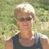
Mom, it turns out, had finished 15 minutes before me. She improved over 30 minutes from her time last year! Awesome! Tanya came across about three hours after me, accomplishing the feat as well. Then the celebration was on.

Mom and I at the finish - way to go, mom!

Tanya tops the final hill
Its in these moments that you find out the most about yourself. Thats what makes these challenges so alluring. On top of it all, the course was beautiful and no doubt strenuous. The other racers make it a great community, as do the all-important and amazing volunteers who run this thing. What an experience. And when 6 pm came, no rapture signaling the worlds end came, how about that? Time to crack a beer and enjoy the mountain evening!
_________________
Mountains complement desert as desert complements city, as wilderness complements and completes civilization. - Ed Abbey |
|
| Back to top |
|
 |
Davis2001R6

Joined: 12 Dec 2003
Posts: 5591
Location: Italy
|
| Posted: 5/26/2011, 9:55 am Post subject: Re: Jemez Mountains 50k, New Mexico |
|
|
|
|
| sbkelley wrote: |
| Its in these moments that you find out the most about yourself. Thats what makes these challenges so alluring. |
I think that about sums up why I love challenges, nicely put Scott and congrats to all of you!
_________________
Please checkout our website for all our travels http://jdombstravels.com/
Give us a like on Facebook too please!
http://www.facebook.com/jdombstravels |
|
| Back to top |
|
|
paintninaz

Joined: 06 Jan 2003
Posts: 3515
|
| Posted: 5/26/2011, 2:05 pm Post subject: |
|
|
|
|
Scott, I loved reading your description of this!!! You make even those grueling uphills sound (almost) fun!! 
What a fantastic accomplishment for both you and Tanya (and your mom, but she seems like she's a pro at this  ), you guys are awesome! ), you guys are awesome!  |
|
| Back to top |
|
|
trekkin_gecko
Joined: 12 Oct 2008
Posts: 7
Location: phoenix
|
| Posted: 5/30/2011, 7:25 pm Post subject: |
|
|
|
|
scott, that's an awesome accomplishment
and kudos to your mom and tanya, too
i've been following some of your training runs/hikes
congrats! |
|
| Back to top |
|
|
wanderingsoul

Joined: 19 Jul 2004
Posts: 2285
Location: Gilbert AZ
|
| Posted: 5/30/2011, 10:39 pm Post subject: |
|
|
|
|
Congrats Scott.... What an awesome accomplishment for you ALL! Excellent job. Sounds like you enjoyed every bit of it
You must feel wonderful to have accomplished this. And Tanya and Your Mom too!
Thanks for sharing your experience.
_________________
Wanderingsoul (Michelle)
Positive Thinking Is the Spark that Makes Dreams Happen~~~Unknown |
|
| Back to top |
|
|
Hikngrl
Canyoneering is my 'Happy Place'

Joined: 27 May 2003
Posts: 5578
Location: Peoria, AZ
|
| Posted: 6/1/2011, 7:51 pm Post subject: |
|
|
|
|
Awesome you guys!!!! So happy for you! What an accomplishment! Thanks for the write up! I enjoyed taking the trip with you from my desk chair!
_________________
~~~Diane~~~
I want to shine! |
|
| Back to top |
|
|
sbkelley
Joined: 20 Feb 2007
Posts: 284
Location: Tempe, AZ
|
| Posted: 6/2/2011, 8:45 am Post subject: |
|
|
|
|
Thanks all! Now who's doing it with us next year? 
_________________
Mountains complement desert as desert complements city, as wilderness complements and completes civilization. - Ed Abbey |
|
| Back to top |
|
|
Hnak

Joined: 06 Jan 2003
Posts: 1766
Location: Prescott, AZ
|
| Posted: 6/2/2011, 10:34 am Post subject: |
|
|
|
|
Great report, thanks! If I tried it next year, would it be ok to walk the course??? 
_________________
The world is older and bigger than we are. This is a hard truth for some folks to swallow. EDWARD ABBEY |
|
| Back to top |
|
|
tibber

Joined: 16 Feb 2004
Posts: 247
Location: Phoenix
|
| Posted: 6/14/2011, 2:47 pm Post subject: |
|
|
|
|
| Quote: |
| I knew I was close, and more importantly, that finishing was a matter of when, not if. |
What a relief that must have been.
| Quote: |
| Time to crack a beer |
"A" is all? 
Very fine and wonderful report. I didn't get too out of breath reading it, ha!
CONGRATULATIONS TO YOU ALL!

_________________
Angela from N Phoenix |
|
| Back to top |
|
|
Shawn
I'll sell you map to Lost Dutchman mine!
Joined: 03 Jan 2003
Posts: 2592
Location: Ahwatukee, AZ
|
| Posted: 6/16/2011, 9:55 am Post subject: |
|
|
|
|
Bravo!
_________________
The bear went over the mountain to see what he could see. |
|
| Back to top |
|
|
|
Back to top
|
|
|
You cannot post new topics in this forum
You cannot reply to topics in this forum
You cannot edit your posts in this forum
You cannot delete your posts in this forum
You cannot vote in polls in this forum
|
|


 Hosted by Gartman
Technical Services.
Hosted by Gartman
Technical Services.